| Eagle Park Campground | |||
| Photo 9 of 9 |
|
||
| Aerial Map | |||

|
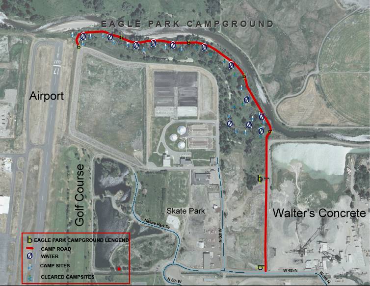
| Areal map of the Eagle park and the surrounding area. You can see the Rexburg Nature Park and part of the Fair grounds to the South. The golf course and air port to the west. Walter's concrete is to the East. |
For more information:
Trails of Madison County
238 E. 3000 N.
Rexburg, ID 83440 US
Email: webmaster@trailsofmadison.org

© Copyright 2009 Madison Rivers Greenway. All rights reserved.