|
|
|
|
The goal of the Madison Rivers Greenways Committee is to plan and develop access and recreation on the riverbanks in Rexburg and throughout Madison County, Idaho. We hopt to promote walking, biking, fishing, jogging, bird watching, cross country skiing, wildlife viewing, picnics, and wildflowers.
|
|
|
The county has approximately 103 miles of rivers including the North and South Forks of the Teton River, Henry's Fork, and the South Fork of the Snake River. The problem is there are very few public access points to these beautiful areas. During spring runoff, parts of the county are threatened by flooding. This causes damage and losses to land owners and burdens public officials with questions about fighting a flood on private property with public assets. One of the major focuses of the Madison Rivers Greenways committee is to prevent future flood disasters by controlling the development in the flood plain. The map to the right indicates the flood plains of the county. The map is also a good perspective of what could be done to turn the flood plain into an integrated recreational and estheticly pleasing rest areas.
|
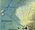
Click for an enlargement |
|
|
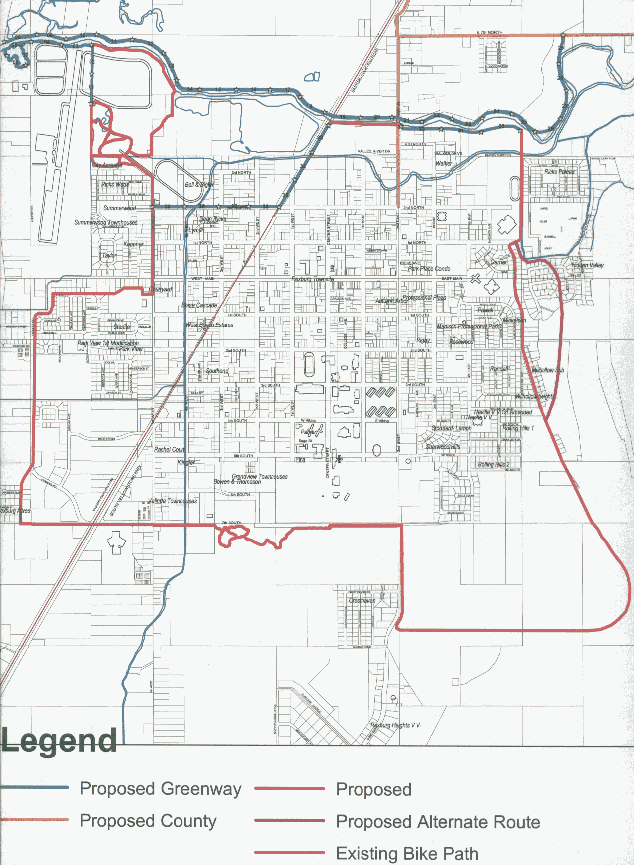
With such a large project, the committee had to hone in on a some managable projects. Fortunately, the availability of land helps set priorities. Currently the projects ready to develop are located within the City of Rexburg. See the areal map at the right. (This is a large graphic and will take a minute to download.) As other parcels of land come available the committee will establish projects to develop them to fit into the overall county plan. The committee is working with private property owners, BYU Idaho, and other government agencies to acquire or jointly develop greenway projects.
|
Click for an enlargement |
|
|
|